One cartographer's hand, across eighty years.
Every map in this world is drawn the same way — real geography, hand-inked over warm aged paper — so the city of the prequel and the corridor of the trilogy feel bound by one hand. This is the first plate: old Thessaloniki in the hunger winter, the upper town tumbling down to an indifferent sea.
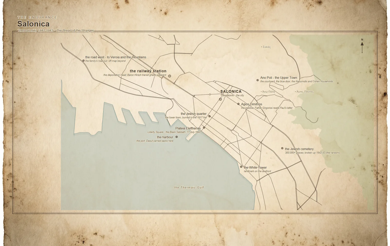
What the map holds
The steep old quarter where the courtyard sits — lanes running down toward the sea.
The great basilica of the city's patron saint, and Father Grigórios's parish.
Liberty Square, by the water, where the city gathers — and where order arrives.
The working port and the old Sephardic lower town beside it.
The city's landmark on the gulf — the fixed point on the shore.
The line running in from the west, and the Baron Hirsch quarter beside it.
On the eastern edge: one of the largest in Europe, centuries old.
One small road off the western edge — the family's road out, toward the mountains.
Each of these opens up on The Places. The mountain village above Véroia, where the family flees, is deliberately off the edge — suggested only by the road running west.
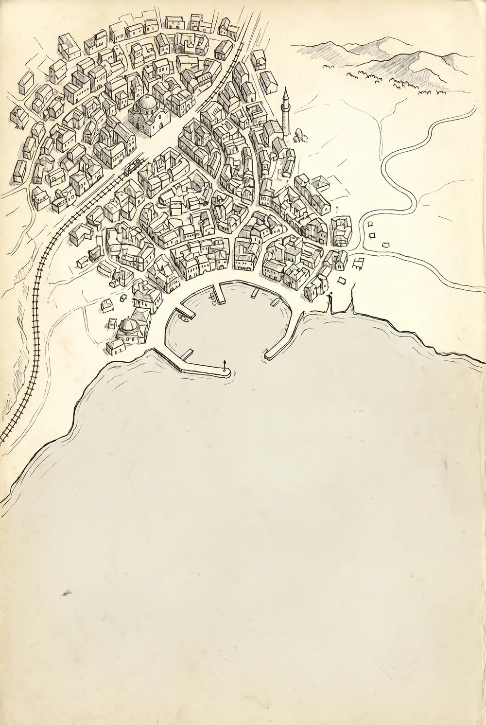
Real ground, drawn by hand.
These are not illustrations of imaginary places. The geography is true — accurate coastlines and streets — selected down to the few features the story needs, then inked over a painted-paper surface in a loose, period line. The result is a feel map: evocative and uncluttered, closer to a memory than a survey.
The same hand will draw the trilogy's ground when the books arrive — the outer-suburban corridor south-east of Melbourne, the ward, the church, the street where it all comes again.
The Corridor — Melbourne's south-east
With the booksThe trilogy's maps — the commuter corridor out to Pakenham, Hannah's patch of it before and after the checkpoints, and the quiet network of a care that won't be registered — are drawn and waiting. They'll go up here as each book is published, so the world fills in as the story does.
The story this world was built for.
The Bread of the Stranger is a complete short story and the seed of everything here — free, and yours to keep. The readers' list is where the rest of the world arrives first.
Get the free prequel